|
531> What happens outside Vegas remains outside: doing the Charleston |
panorama looking west over death valley [high rez] [26 June 2017 | Vegas] Woke up pre-dawn + split as party ppl were stumblin' back to their rooms. Drove out to Mt Charleston .. dirty little secret about Vegas is that just beyond city lmits there's all this good hiking + climbing. Decades ago we used to come here to climb at Red Rocks Canyon + knew about Mt Charleston, but never hiked it cuz we were so obsessed w/ climbing .. so now finally did it (solo cuz our bedder-½ has some conference, why we're here of course). Combined the south + north loops, starting w/ th south. There were a few other cars in the Cathedral Peak parking lot, but i passed all of them early on + after that didnt see anyone until the top. My idea of a good time.
on the south loop trail going up (looking at the cockscomb) The trail rose quickly up to the ridgeline at around 11,000 feet + from there most of the hike was above 11k, so nice + cool, the air felt good on the lungs. From one side you could see down thru the haze to Vegas + then on the other side of the ridge u could see down into California.
on th ridge looking down towards death valley
bonsaish bristlecones abound
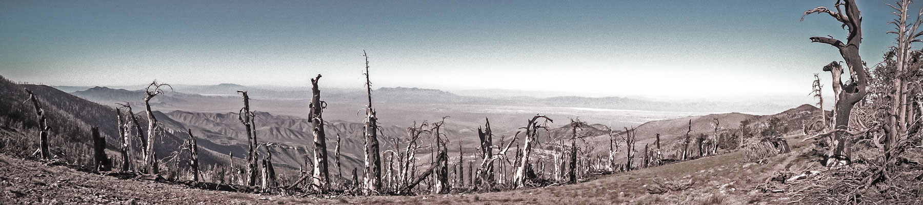
There was a fire 4 years ago that burned a big swath of forest up on the ridge + evidently the trail has been closed until recently.
burned out forest
Then up the ridge to the top of Mt Charleson (11,916 ft), spotted the wreckage of some plane (evidently a transport plane going to area 51 that crashed in the 50s).
the last bit up Mt Charleston
plane wreckage
looking down towards area 51 where the plane was headed A few members from some hiking club were loitering on top taking photos of themselves, fully equipped like they were on a major expedition. One guy in army fatiques + what looked like a gas mask was flabbergasted that i didnt have ski poles or an ice axe to self-arrest and was only wearing running shoes, he said that at a few spots on the way up he almost fell off the mountain were it not for his poles. I thanked him for his concern and said i'd be okay, then went on my way down the north loop, through forests of gnarly bristlecones, all stunted like bonsais. Pretty spectacular hike, lots of variety, and exposure, clear views + you could see your topology, where you came from + where you were going.
on the north loop trail heading down
gnarly gnob
looking back at Mt Charleston
the distant ridge i traversed up
Hard to get a strait answer off the inurnet but the way i did it i think was around 19-20 miles, including the mile or so walking back along the road to where i parked, since the trails dont start at the same place. Took about 8 hours. |
|
| 530 <( )> 532 > Assisted living in the valley of fire | |
|
|
[ (ɔ)om.Postd 2017 Rem+Rom | calamari archive ] |
|